Thursday, May 28, 2015

Day 19 Zero at Fontana Village

Thursday, 28 May 2015

I'm taking an unplanned zero waiting on my mail drop. 

The one drawback of Fontana Village seems to be the slow WiFi and non-existent AT&T and Verizon cellular. I downloaded a speed app and checked the WiFi. Its about 2.75 Mbps down, 0.25 to 0.33 Mbps up, and a latency that ranges from 100-200 ms. So at 0.25 up, it takes 4 sec for 1 Mb or 15 Mb per minute. My average photo is 4.5 MB or 36 Mb. So a photo, ignoring packet latency, ought to upload in about 2 ½ minutes. I use 4 photos per blog, so a blog with upload should take about 10 minutes. That assumes no long system ‘pauses’ that cause a timeout or error. I’ll try one, but I expect the upload to fail. 

As expected a 2-photo blog failed to upload after 7 minutes, with an error. I’ll have to wait for a better signal location. 

I was looking forward to dinner last night, but the clothes were still wet. So I had coffee and chex mix in the room. Kind of a let down. 

But breakfast this morning was great. Moderately priced and perfectly cooked. 

I checked USPS tracking and it didn't show any progress on my box. Being a day late is costing me dollars and time. If it doesn't make it today I’ll probably reprovision at the resort store and leave it. That will make this one expensive zero!

I also asked about a shuttle to the trail in the morning. She said only if it was running and she would check. That’s a rough two extra miles to walk. 

The store is quite a ways down the hill. I don't want to walk it till I find out whether I have to buy food. 

While wasting time I downloaded an app to reduce the size of my photos so I can upload with my blog posts. I was successful in adding them to the last few blogs. I marked those ‘reduced photos’ so I can go back later and replace them with hi-res photos. 

The mail drop didn’t show. The Greenville post office says it was sent for delivery this morning at 0730. That’s a three hour drive. This is Priority Mail due today. Very irritating!!  I waffled about what to do. My schedule was already way behind. With the local post office not opening till 1145 tomorrow, that’s about the soonest I can get the package. But I hate to pay $40 at the local store and leave at 0930 when the package should show up 3 hours later. 

You’ll get the rest of the story tomorrow. Just to include a photo, here’s a shot of part of the room. 


Wednesday, May 27, 2015

Day 18 Cable Gap Shelter to Fontana 28 AT Crossing

From 159.2 to 164.7 or 5.5 miles. Started 6:45 and finished at 10:20 am. 

Wednesday, 27 May 2015


After I got to the shelter yesterday everybody started showing up. Two section hikers tented. Two college graduates split hammocking and using the shelter. One southbound flip-flopper came into the shelter. One NOBO hiker Krispy Krème came in after 19 miles. He was about my age. Then six hikers arrived after the heavy rain began. I think they tented. 

It rained about the first half of the night. But was clear all morning into Fontana. A couple of interesting notes on the hikers. Krispy Kreme had dehydrated donuts a friend had made for him. The other guys thought they were good.  One of the graduates was a EE from Liberty going to Johns Hopkins APL. During my career I saw lots of great projects there. I was a little envious. 

I left the shelter first, but Braveheart and the college graduates passed me, but just by a little!

When I got to the Fontana Marina, a couple of waiting guys asked about Krispy Kreme. I figured he wasn't far back. One of them gave me a ride to the lodge, and a brownie!  My first trail magic. Great folks. The lodge is pretty impressive. But its way down hill to the laundry, store and post office. I went about halfway down for lunch (pulled pork) at the Wildwood Grill. Then I used Dr Bonner and the sink to wash out my clothes. 

The torrential rains in Texas delayed my mail drop (and lack of signal to get email to my wife).  So I’m staying a second night to get the food package for the Smokies. I’m already delayed enough. But its either stay an extra night or pay for supplies at the resort store.  But it is nice here!

A couple of comments about apps and signal. Only slow WiFi here so it will be awhile till I get pictures up on the posts. 

You’ll remember two apps disappeared from my iPhone a couple of days back. I lost a local blog. I started using Pages to author the blogs and then copy text to BlogTouch Pro. Figured an Apple iOS app ought to be safe. But yesterday I had to catch up and write two blogs (people were sociable the night before). Well Pages lost half of one!  The rewrite was lots shorter. This one I am writing in Word. The interface is a lot nicer. Hope the stability and safety is too!

It's mid afternoon, but I‘ll leave today's blog at this point. Have a good one!

I tried some photo reduction apps. Lets see if the Wildwood Grill veranda makes it. 


Day 17 Locust Cove Gap to Cable Gap Shelter

From 147.6 to 159.2 or 11.6 miles. Started 7:00 finished 4:30.

Tuesday, 26 May 2015


I actually slept relatively well last night during the continuous rain. I found I could lift the edge of the cuben bathtub floor of the bivy to stop the rain splash. 

I packed up under the tarp and put on my rain gear. As soon as I got the tarp down the rain stopped. I got on the trail by 7:00 am. By about 07:30 I was overheated and took off the rain jacket. Didn't take off the rain pants and pants leggings until about 1130. Waiting was a mistake. The leggings are still wet. 

The fog lifted about 1130 and I got some great photos. 

I decided to stay in the shelter tonight to avoid the rain. I got here and ate before it started raining about 5:30. Although I saw no one all day 5 people got here after I arrived. Hopefully the mice will be nice.


Day 16 NOC to Locust Cove Gap

From 137.3 to 147.6 or 10.3 miles. Started 8:48 finished 4:30.

Monday, 25 May 2015


The 'room' last night at the NOC wasn't what I expected. No bed, just bunks. Nothing else. Plus to get to the restrooms and kitchen I had to go up 72 stairs. Plus it was about a quarter mile uphill from the NOC complex to the rooms and bunkhouse. 

I stayed for breakfast and got on the trail about 8:48. It went up for 3000'!  Nice weather though. 

After I set up my tarp, five tents of people showed up. None of them thrus. It started raining as soon as I got in the quilt.


Sunday, May 24, 2015

Day 14 Wayah Crest Picnic Area to Cold Spring Shelter

From 115.6 to 125.7 or 10.1 miles. Started 7:30 and finished 4:20 pm. 

Saturday May 23, 2015. 


This is a post that disappeared before I could publish it. 

Another nice day. I again took it easy on the ankle. I listened to John Denver and then Skywalker's audio book on the AT before hitting the sack. 

There was a busy gravel road up to Wayah Bald with a parking lot 100 yards on a paved path from the top. A really nice stone observation tower let you see great distances. 

At the last road crossing, they was a large church bus. But they weren't at the shelter or camp sites. I got a nice camp site on the ridge except for the wind. Skywalker was again entertaining.


Day 15 Cool Spring Shelter to Nantahala Outdoor Center

From 125.7 to 137.5 or 11.8 miles. Started 7:22 and finished 4:25 pm. 

Sunday May 24, 2015


I had a near ideal camping site yesterday. Up on a ridge but sheltered from the fierce wind. The problem was you didn't want to be outside the tarp, bivy and quilt. So when I got up this morning I headed out. Weather was nice but fog moved in before I left. Just fog for the first two bald 'views'. 

The last bald though was fantastic with a great observation tower. Thought it would be all downhill today, but there were plenty of ups. The long downhill though had some of the worst terrain yet. 

Just after noon I became concerned I might have taken a side trail. I got out the iPhone to check my position with Guthook's AT Hiker app. It was gone!  So was the BlogTouch Pro app and yesterday's blog (no signal so it was saved local).  I was pretty irritated. Somehow I had also lost 33% of the battery charge while in airplane mode with the screen off. I figure it must have been an iOS bug. 

I checked signal and had 3 bars, so I re-downloaded the apps. I also called and got a room here at the NOC. AWOL's guide said the NOC closed at 5:00 so I booked it. Turns out it's 8:00 pm that the NOC closes. Got a good meal and a shower. But there's a large family squatting on the veranda, so I'm writing this from the community kitchen. The NOC's zip-lines, kayaks and rafts make this look like a great place to visit.


Saturday, May 23, 2015

Day 13 (29) Winding Stair Gap to Wayah Crest Picnic Area

From 109.8 to 115.6 or 5.8 miles. Started 11:12 am, finished about 3:40 pm.

Friday, May 22, 2015 (actual day on the trail: 13 including 1 zero in Hiawassee and 1 Zero in Franklin--my best estimate of what an uninterrupted hike would be)


As I promised I took it easy the first day back. I was actually surprised the ankle held up. I went slow and carefully, and I stopped for breaks every hour. Every time a muscle tweaked I panicked, then realized it was just the normal muscle reactions to the trail. 

The trees have filled in and there wasn't much in the way of views. Siler Bald didn't look bald from 0.2 miles down. Should have gone up but decided to take it easy and skip the side trail. This was a nice section to test the ankle. One of the easiest stretches yet.

I camped in a picnic area with three concrete picnic tables.  It was a bit noisy as it was near a parking area, and the road up to the next bald.  But there wasn't anyone else here.
Last night I stayed in a Hampton Inn in Montgomery AL. There were bedbugs in the room in Franklin and I wasn't going through that again. In fact, I wasn't impressed with Franklin. For someone with a sore ankle, it's hills are close to my vision of hell. I tried to switch hotels, but the others had no rooms free due to a gem show. When I called on a Friday to get a rental car I was told they wouldn't have any cars till Monday.  Today, my ride back to the trail from Franklin took me 15 miles in the wrong direction before noticing the error. 

Anyway the drive through Atlanta this morning during rush hour actually went pretty well. But I left Montgomery at 0400 to hit Atlanta early. 

I saw a couple of unusual wildlife today. I have a picture of the snail. I think I saw two dead moles on the trail. One had its head chewed and the other its rear. Not sure why whatever got them didn't eat them. 

More bugs now. The permethrin seems to be working on most. But no-seeums keep crawling across my hands while I type. 

Its only 5:42 and I'm finished with dinner and just about with the blog. What to do?  Have s good evening!


Wednesday, May 20, 2015

AT Update and Photo Album

Well, I've taken most of two weeks off to see if the ankle would get better.  It did seem to vastly improve, though I still have some twinges.  I'm going to drive back for a retry starting at Winding Stair Gap on Friday.  Hopefully, the ankle will survive the car drive--they seem as punishing as the trail!  I will intentionally go slower with fewer miles if it seems strong enough to start.

Here's a photo album for the previous two sections of the trail:

Thursday, May 7, 2015

Injury Decision Point

Thursday, May 7, 2015

This is the last day I'm willing to give the ankle here in Franklin. I'll test it here in the inclined parking lot in the morning. If I don't have any pain walking up and down, I'll restart the trail. Otherwise, I'll discontinue the blog and effort for a bit. I really believe the ligaments or tendons above the ankle were stressed--I hope not torn. I don't want to risk any worse damage. 

Have a good day!

Wednesday, May 6, 2015

Day 13 Still in Franklin NC

Wednesday, May 6, 2015

I decided to give the ankle another couple of days. Staying off of it is boring.  Having an iPhone instead of a PC is pretty restrictive, and for an old guy, the text is too small. For anybody thinking about retirement, I suggest you not rely on today's TV programming for entertainment. 

Wish I had more to write about. Have a good day!

Tuesday, May 5, 2015

Day 12 A Zero in Franklin NC

Haven's Budget Inn, Franklin NC
Tuesday, May 5, 2015

I finished the planning and packing chores this morning. But the ankle discomfort is still there. The Outfitter mentioned that ligaments and tendons can take 100 hours to heal. I'm trying to stay off it. But Franklin by foot is a poor place to let an ankle heal. Nothing is flat. I gave up on finding Ibuprofen when the waitress at lunch pointed me towards Ingles as being the closest. I walked outside and saw it down in the valley. It was bad enough getting up the hill to Main street. Trekking poles can help on the trail. But you cannot use them on pavement.

I checked the Internet last night trying to find a local place for breakfast. Nothing was open till lunch, so I had pizza. I walked up to the Motor Co Grill for lunch (a diner configured like a Mobile gas station) and they were still serving breakfast!  Real eggs, grits, hash browns, and bacon. 

Figured I would use some time to describe my pack and camping/hiking approach. First my pack...


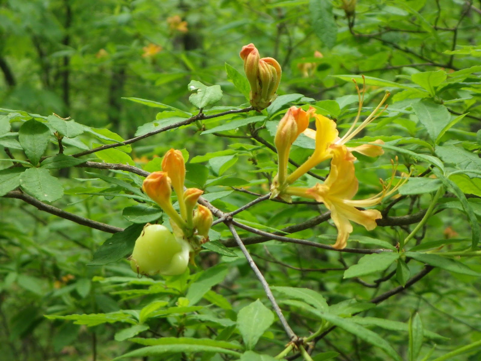
It's a 19 oz ArcBlast cuben fiber pack from ZPacks. In the right shoulder pouch I carry my SteriPen for UV water purification. Easy to get to when I need it. In the left shoulder pouch I carry my waterproof camera. I can pull it out at.a moment's notice. Though I wasn't fast enough to get a shot of the squirrel, the largest wildlife I've seen so far. :-)

In the right waist pouch I carry snacks, my toothbrush and little bottles of sunscreen and bug juice. In the left waist pouch I carry my trowel, toilet paper, hand cleaner, headlamp and small multi-tool.  I don't get into that pouch often. 

At the moment I have the trekking poles shortened and resting in the side pockets. I usually have my water bottles there. A wide-mouth Nalgene for collecting water. The SteriPen needs the wide mouth to fit. I pour the purified water into a one liter Dasani bottle with a pop up lid, and drink from that. 


The front of the pack has a big mesh pocket. I usually carry my tent stake bag there, my guide book pages, a small ground cloth for my pack, wind shirt and/or rain jacket, and if my tarp or bivy get wet, those too. 

Inside the pack I keep my sleeping quilt in a compactor bag. I'll also have the air pad, clothes, toiletries, electronics, stove, and food!  Without food and water, the pack weight is around 12 lbs. Food adds 4 to 6 lbs, and two liters of water (the most I need for drier stretches) is another 4.4 lbs. It's light compared to many on the trail, but it gets heavy enough on those uphills. 

Now for my camping approach. I prefer the tarp to shelters. You don't bother anyone, no snoring noises, and no scampering, chewing mice!  But its hard to find flat ground and my tarp is relatively big at 8.5 ft square. Even pitched high on a clear night it uses a lot of space. I put my air pad in my bivy and my quilt inside on top of the pad. The bivy is supposed to protect the down quilt from rain splash or running water. It has a bug net in the face area, so I usually have to wear a beanie or down hood. The quilt is good to about 30 degrees and I usually wear some or all of my clothes and layers for warmth. I've never yet been cold. I do turn over a lot at night. With a bivy, air pad and quilt that's not the easiest thing to do. 

If it's wet on the morning, you have to be careful in packing. I always spread on some foot goo in the morning and evening. It'll take me about 45 minutes to pack up the tarp and pack. If I eat granola or oats another 15. 

I start the day with enough water and snacks. I get up when the birds wake me, usually about 6:15 am. I try to get on the trail early. I'll stop for a moment to drink about every 30 minutes. Have to stop since I don't use a bladder, carry the trekking poles, and don't want to drop and potentially lose a water bottle. Lots of trail is on a narrow path with a LONG drop-off. 

When I get to a good (nice little flow easy to get the bottle under) water source I fill up. When my Dasani empties, I use the SteriPen and refill the Dasani. Even though I'm a slow hiker, I pass many that use slower water filter systems. 

I stop every couple of hours for a snack break. Usually for about 5-7 minutes. At lunch I'll take 10-15 and make sure to take off the pack. If I need to dry off the tarp or bivy, I'll take a luxurious 30 minutes. 

I do stop for a moment or two at other times during the day: photo opps, uphill breathing rests, short conversations with other hikers, and occasionally to check cell service and email. 

I like to stop between 6:00 and 6:30 pm to have enough time to setup, cook/eat, get water, and blog. I try to go to sleep shortly after it gets dark. 

That's my approach. It's pretty interesting seeing how others do it!  By the way, it seems like most of the other thrus I've met the last few days were in Outdoor 76 outfitters yesterday and today. 

I want to get back on the AT, and waiting and hoping for my ankle to feel better is frustrating and a bit worrisome. 

Have a good day!

Monday, May 4, 2015

Day 11 Long Branch Shelter to Winding Stair Gap / Franklin NC

102.5 to 109.8 or 7.3 miles total. Started 6:45, finished 12:00
Monday May 4, 2015

location: GPS@35°10'56"N 83°22'39"W (2038.1 ft)
Here's today's elevation profile:

The muscle near the ankle is still sore. I walked safe, and was kind of proud of my progress. The Ibuprofen didn't hurt. I'm going to take a zero or maybe two to see if it gets better. 

I stayed in the shelter. Only my second and the first with mice. The NC shelters don't seem as clean as the ones in GA. The mice didn't get into anything that I could tell. 

I shared the shelter with three others:  Big Respiratory System, Pudding Face and a lady from Berlin that is tagging along with them. I got their trail names reluctantly. Nice people though the German really didn't speak English. 

It was another nice day and the terrain was kind to me. 

The room here is clearly assigned to thru hikers. Not where I would stay with my wife. 

Went by the Outdoor 76 outfitters and discussed my sore ankle. I realized while there the pain is mostly above the ankle. Got some insoles anyway to provide a little more support. I did my laundry and ordered pizza. Downtown is close but not the usual chains. 

I've got strong AT&T and Verizon, so I'll get my photos up shortly. Here's today's.  Vistas were scarce today. Have a good evening!

Long Branch Shelter


Day 10 Unofficial Site to Long Branch Shelter

91.7 to 102.5 or 10.8 miles. Started 7:45am and finished 4:45pm.
Sunday May 3, 2015, photos added

Here's today's elevation profile:

Figure not bad for taking it slow with a sore ankle all day. Some of the trail was pretty rough. 

First wanted to hit an encounter yesterday and the day before I missed. Bigfoot and Birder were heading south both days. They are shuttling their car and doing day hikes. They've gone from NY and are headed to Springer Mountain. 

Much of today's trail was nice. But the climb up Albert Mountain was an ankle buster. :-)  They had an alternate route but it skipped the 100 mile point. Several great views and I'll get the pictures up tomorrow in Franklin. 

The Ibuprofen made the ankle walkable. Uphill didn't usually hurt at all. Downhill felt terrible. 

Decided to stop early and stay in the shelter. Have about 7.3 miles tomorrow before I catch a ride into Franklin. 

Have a good night!

Much of the trails are rhododendron tunnels. At the Albert Mountain fire tower, with my fear of heights, I only went up part way. Course I'll tell everybody it was my ankle.  That's it!

Albert Mountain Fire Tower

Sunday, May 3, 2015

Day 9 Bly Gap to Unofficial Tent Site

78.6 to 91.7 or 13.1 miles total. Started 7:05am finished 5:20pm. With thr 8.8 mile approach trail I've now walked over 100 miles.

Saturday May 2, 2015, photos added 5/4  Here's today's elevation profile:


The Bly Gap site wasn't ideal. No flat ground, silty water, and no private area to take a leak. 

I only ate bananas for breakfast; so I ended up eating all my snacks. I hydrated better today than yesterday. Dinner was beef stroganoff, broccoli and ghee mixed together. Good!

Today wasn't as windy but seemed cloudier. Again not much opportunity for vista photos. And for the first time no cell service anywhere. 

I noticed the last couple of days my right sock was twisted on my foot. I figured I wasn't planting the foot straight so today I tried to walk 'correct'. I could feel the strain in the ankle muscles. When I hit the rocky downhill this afternoon it got sore. I slowed down and decided to stop earlier. The first tent site with water was packed with weekenders. I moved on, got water, and found this site. 

Secluded!

I'm about to do my nightly foot care. Also going to listen to some music. Then hit the sack. 

Good night!  Since no vistas, here's my tarp setup. 


Friday, May 1, 2015

Day 7 Unicoi Gap to Deep Gap Shelter

52.9 to 66.0 or 13.1 miles. Started 9:24 am finished 6:25 pm.

Thursday April 30, 2015, photos added 5/4  Here's today's elevation profile:

Nice day till it started raining this evening. Saw Butterbeard at Unicoi when I was dropped off. He was just headed into Hiawassee. He spent some time getting his pack weight down back at Mountain Crossings. Also saw the young couple from Amicalola. They are headed into Hiawassee tomorrow. 

Felt better and a bit stronger today. Anyway here's the photos.  (Photos errored out during upload, see below)

Have a good night!


Day 8 Deep Gap Shelter to Bly Gap NC

From 66.0 to 78.6 or 12.6 miles. Started 7:45am and finished 5:30 pm.

Friday May 1, 2015, photos added 5/4  Here's today's elevation profile:

I'm going to change my blog approach. No pictures till town and then I'll add them to the right days. Had 3 bars today and the photos errored out on BlogTouch Pro. 

I tarped last night and made it in just before the rain at 8:00. About the time it stopped at 10:00 I noticed lights. A couple walked through the rain and up the mountain in the dark. Then instead of using the empty shelter they set up their tent!

At midnight I realized my feet were above my head and I needed to reverse. That meant restaking the tarp. Worked.

When I hit the trail this morning the wind was fierce. I put everything on!

It did warm up by about 11:00. But not much in the way of photos but trees. A really nice day after the wind. 

Met a soutbounder. He started in Maine last June. But got off in November to avoid the Smokies. He's about done now. 

I hit North Carolina just before this camp site. Buggy and not very flat. Young couple from Mountain Crossings is here. Think they took the best spot. Another couple came by but went on since no flat spaces left. 

Have a good night!

Photos added 5/4:
Lots of the trees here are malformed. Frequently they seem to have sagged with resulting bulges. That's it!