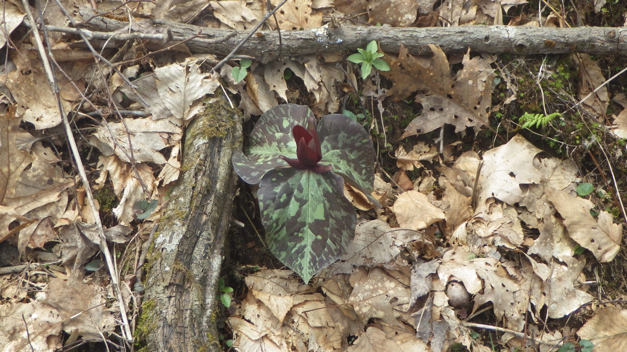
Friday, April 15, 2016

Day 3 Stealth Site to Lance Creek

Friday, April 15, 2016, AT Mile 24.3
------------------------------
Walked from 21.0 to 31.3 or 10.3 miles.
Started 07:40 AM, stopped 03:27 PM.
Ave mph was 1.32, excluding lunch.
Battery used:  7 percent
------------------------------
Last night was pretty peaceful. Occasional gusts of wind, and my habitual rolling from side to back to side to minimize the calf discomfort. I kept the food bag in the tent and didn't see any bears (:-)

Please note this app's mileage is not in sync with the official trail. My GPX file starts the zero mile at the start of the approach trail, 8.8 miles before the official start of the AT. 

I feel a lot better today. Less miles and the knee was better. I pushed hard the last 4 miles to get one of the 6 camp sites here. In a mile bear canisters are required for camping until you get over Blood Mountain. I didn't want to risk my knee by pushing over the mountain today. 

The weather continues nice but windy. It does get cold at night and the strong winds get through the mesh around my bathtub flooring. The mesh is meant for ventilation to prevent condensation. 

I was able to make a call to Susan with just one bar. I couldn't do that with the phone last year. A couple of good shots today but I won't post them till I get a strong signal. Have a good day!


Day 2 Springer Mt to Stealth Site

Thursday, April 14, 2016
------------------------------
Walked from  0.2 to 13.4 or 13.2 miles.
Started 07:36 AM, stopped 05:47 PM.
Ave mph was 1.32, excluding lunch.
Battery used:  4 percent
------------------------------
I did a little better on my app usage, but forgot to take it out of airplane mode to use the GPS when I started. Hence the elevation profile is wrong. 

I went slow and careful today to make sure my knee was okay. It seemed to be better as the day went on. I'm camped at a stealth site, I just got too tired to make it to a shelter. Lots of steep ups and downs today. 

I was comfortable last night but the wind howled continuously. And it came in under the tent. It rained lightly most of the night but the wind dried the tent by morning. 

The trail ranger mentioned an airplane crash. There were helicopters continuously till about 11:00 pm. Kind of sounded like what the Berlin Airlift would have sounded like with rotary aircraft. You couldn't here the wind then or get any sleep. 

It's warmer and calmer this evening. Almost no wind. 

I got an early start and the pack didn't overtake me like I expected. Maybe 2 or 3 hikers passed me. Caught up to Top who started at Springer and not Amicalola. Think his big pack is slowing him down. As you can see I was not going fast!

Tomorrow I'm going to keep it down to about ten miles. Today really took it out of me. Never saw more than one bar of AT&T so no pictures or posting yet. 

I think the elevation profile is for my first two days. 


Day 1 Amicalola Falls to Springer Mountain

AT Mile -8.8 to +0.2 miles. 

In getting started I forgot to use my app. So you don't see an elevation profile and hiking specs. Fitbit says I hiked about 25,400 steps, 11 miles and used about 3000 calories. My guide says I walked 8.8 miles on the Approach trail and 0.2 on the AT or just nine miles. This year I wasn't hiking with anyone so I went slower. I was also babying aches in the left ankle and right knee.

The 700 stair steps up the falls and the 1500 foot climb were torture. You don't get hill climbing practice or lungs in Texas state parks. The wind was pretty fierce all day with mostly clouds. It's going to be a cold night. 

The group from the hostel were great and most of them are here. Though the ones I talked most with skipped the approach trail and so are a day ahead. That included Jewel a double crowner (AT and PCT) who is redoing the AT. She's older than me!  A couple of young folks from England. And lots of others from around the country. Most don't have trail names yet. It was pretty interesting watching so many of them fix dinner. The majority ha canister stoves. A couple alcohol. And one guy had white gas. He spilled his priming and set the picnic table on fire. Though it just blazed till the spilled gas was consumed. There's one of the AT trail runners assigned here (volunteers).  I didn't see any last year; he seemed disapproving!

My new tent went up a lot better than in the rocky ground in Colorado. But with the tie-outs it's almost bigger than the space I have. I hope the breeze dies down, the tent is well ventilated!  I'm going to wear three layers tonight. 

The falls and scenery were gorgeous today, but photos will have to wait till I get better signal. Good night. 


Tuesday, April 12, 2016

Hiker Hostel in Dahlonega GA

Tomorrow I start the Appalachian Trail again. Today I got to within driving distance. The flights on American were great. Even the luggage service was quick. But then I had to dawdle in the airport at Atlanta for two hours. Some unusual folks there.

After that I took the MARTA train to the northern most stop and waited for another 6 hikers and the shuttle to arrive. That was more interesting as I could talk to the other hikers. Then an hour drive to Dahlonega with a 30 minute stop at Walmart/Subway to get dinner. 

The Hiker Hostel provides a thru-hiker package that includes bunk, shuttles, breakfast, and alcohol (only fuel (:-) for $85. A taxi from Atlanta to the trail is about $150.  Spent a couple hours trying to get everything set up here. The hostel location ought to be showing under Cipher on the blog. Not much to photo here--should have got the 14 chickens!  Here's what I've got. 

Hostel


Thursday, April 7, 2016

Gear List, AT, April 2016

This is the gear list for my 2016 AT hike that I'm using for packing purposes.  Please note that food is light for my first two weeks.  Also, I'll probably carry 2 liters of water most of the time when departing my camp site.

Here's a shot of my gear bagged and ready to insert into my pack.  Obviously, the down bag and puffy haven't been compressed yet.


Appalachian Trail, April, 2016


Item oz (ea) # oz (total)
Packed Items
Pack
ZPacks Arc Blast 60L, Hybrid Cuben (2014) 19.8 1 19.8
Trash Compactor Liner 20 gallon 2.1 1 2.1
Backup Wallet add-on (homemade) 0.49 1 0.49
Shelter
Zpacks Altaplex Cuben Tent 17.56 1 17.56
Tarp Stake Kit (12 stakes) w sack 3.46 1 3.46
12" Carbon Fiber Trekking Pole Extender 0.67 1 0.67
Cuben Sit Cloth 3'x3' 1.51 1 1.51
Sleeping System
Katabatic Palisades 30 Sleeping Quilt, 6'6" 18.8 1 18.8
Thermarest NeoAir Xlite, 72" (Regular), Inflatable 12 1 12
Stove & Cooking
Fissure Tri-Ti w Toaks 850 ml Ti Pot, 12-10 Stove 5.96 1 5.96
Cuben Pot Stuff Sack for Toaks 0.14 1 0.14
Glad Lockware Extra Small, 9.2 oz cup with lid 1.2 1 1.2
Fuel bottle, alcohol, 8 oz (16 meals) 1 1 1
Gallon Baggy for Fuel Bottle 0.32 1 0.32
Aluminum foil (1' square) 0.28 1 0.28
Titanium Spoon - Folding (Toaks with bag) 0.67 1 0.67
Matches, Kitchen (book w/o cover) 0.1 1 0.1
Mini-Bic Lighter 0.4 5 2
ZPacks Bear Bagging Kit (carabiner, sacks + 50' Zline slick cord) 2.6 1 2.6
Tyvek Warming Pouch for Quart Ziplocks 0.63 1 0.63
Loksak 12x20 odor-proof OPSAK 1.5 1 1.5
Hydration
SteriPen Classic 3 w 4 AA Lithium 4.94 1 4.94
Aquamira Chlorine Dioxide Water Purifier Tablets, 24 0 1 0
Nalgene HDPE Ultralite 1 L Wide-Mouth Bottle 3.84 1 3.84
Dasani Water Bottle (1 L) w Platypus Push/Pull Top 1.1 1 1.1
Platypus 2 L Platy Bottle (70 oz) 1.34 1 1.34
Toiletries & Skin/Bug Protection
Vivera Retainers 0.14 1 0.14
QiWiz Original Trowel, Ti, 6" 0.42 1 0.42
Inox Nail Scissors w cover, Matt Finish, Stainless Steel 0.88 1 0.88
Emory Nail File 0 1 0
Light comb, black 0 1 0
Purell in 30 ml squeeze bottle 1.34 1 1.34
Dr Bonner in large 30ml dropper bottle w baggy 1.48 1 1.48
Dental Kit Small (toothbrush, floss, powdered paste, lip balm) 1.23 1 1.23
Sunscreen in large plastic squeeze bottle 2.68 1 2.68
Bug repellant (Picardin) in 30 ml large dropper bottle 1.31 1 1.31
Earplugs, yellow foam 0 1 0
Sea to Summit Headnet 0.9 1 0.9
Jif jar, small 1.23 1 1.23
Utilities and Navigation
Petzl e+LITE Ultra Compact 2-LED Headlamp w Retractable Cord 0.92 1 0.92
Guide Pages/Maps 2 1 2
Mini-glasses (1.5) in soft case 0 1 0
Fisher Space Pen, Stowaway 0.18 1 0.18
Leatherman Micro, Red AL 1.9 1 1.9
Electronics & Photography
Delorme inReach Explorer 6.91 1 6.91
Ricoh WG-4 GPS (Pentax) Camera, 32 GB, Halcyon 1500 mAh 8.22 1 8.22
Sandisk Sansa Clip Sport 8 GB (yellow) w 32 GB Micro SDHC 1.02 1 1.02
RavPower 3350 mAh External Battery, Black & White 2.54 1 2.54
Anker 20W 4A Dual-Port Wall Charger, 7109 Power IQ 2 2.29 1 2.29
Ricoh D-Li92, 3.7 V, 850 mAh 0.67 2 1.34
PowerMart USB Battery Charger for D-Li92 w/o cable 1.27 1 1.27
Micro USB Cable, 1m (black, Amazon) 1.31 1 1.31
Syncwire Lightning USB Cable (1m, white) 0.6 1 0.6
Bose SoundSport Ear Buds (white) 0.71 1 0.71
Gear Repair Kit
Baggy: Neo-Air, Cuben Tape, Pertex Tape, Floss, Needle 2.12 1 2.12
First Aid
First-Aid Kit + Pills + Aqua Mira Tablets 2.75 1 2.75
Benadryl/Ibuprofen/Acetomeniphen/Ammodium/Zantac 0 1 0
Hiker (Feet) Goo in green plastic container 1.31 1 1.31
Hat / Gloves / Socks
ZPacks Micro-Fleece Hat (black) 1 1 1
Buff, Afghan Graphite (Original Buff, polyester microfiber) 1.31 1 1.31
Lightload Pack Towel 0.6 1 0.6
Possumdown Gloves (L, black) 1.52 1 1.52
ZPacks Cuben Rain Mitts 1.13 1 1.13
Darn Tough Light Hiker Micro Crew (L) 2.1 1 2.1
Darn Tough Hike-Trek Micro Crew (L) 2.7 1 2.7
Clothing Layers
Zpacks Medium Pillow Cuben Fiber Dry Bag 1.62 1 1.62
SeaToSummit Ultra-Sil Nano Drysack 8 L (for rain stuff, Orange) 0.8 1 0.8
ExOfficio Give-N-Go Sport Mesh Brief (M, Curfew) 1.7 1 1.7
Smartwool NTS Micro 150 Pattern SS T (M, Silver Grey Heather) 4.7 1 4.7
Patagonia Houdini Jacket, Eclectic Orange (L) 3.2 1 3.2
Outdoor Research Helium II Rain Jacket (L, gray) 5.3 1 5.3
Montbell Versalite (rain) Pants (black, L) including sack 4 1 4
Mountain Hardware Ghost Down Jacket (silver, no hood) 7 1 7
Base Weight (lbs) 12.0


Consumables…
Breakfast 3.84 4 15.36
Lunch 4.37 0 0
Snacks 9.37 4 37.48
Dinner 6.31 4 25.24
Fuel, Alcohol (0.75 fl oz/day - one meal/day only) 6.66 1 6.66
Water (35.2 oz/L) 35.2 1 35.2
Toilet Paper Small (8 squares + baggy) 0.18 8 1.44
Comsumables (lbs) 7.5
Total Pack Weight (lbs) 19.5


Worn or Carried Items…
Trekking Poles
Black Diamond Contour Elliptical Trekking Poles 9.5 2 19
Duct Tape around trekking pole (5'/pole) 0.4 1 0.4
Shoes / Boots
Altra Lone Peaks 2 Trail Runners (11.5), Low Cut (Black) 12.8 2 25.6
Clothing
Headsweats Protech White/Grey Coolmax (w neck sunshield) 2.3 1 2.3
Smartwool NTS Light 195 Zip T 8.8 1 8.8
ExOfficio Sport Mesh 9" Boxer Brief (M) 2.7 2 5.4
Columbia Covertible II Pant (Sage, M, 34"L) 11.46 1 11.46
Darn Tough Light Hiker Micro Crew (L) 2.1 1 2.1
Miscellaneous
iPhone 6S Plus with Lifeproof Nuud case (space gray/black) 8.68 1 8.68
Fitbit Zip 0.25 1 0.25
Suncloud Pursuit Polarized Sunglasses, Gray w Neck Loop 1.09 1 1.09
Reading Glasses w Case (Brown or Gray) 1.13 1 1.13
Bandana (cotton) 0.8 1 0.8
Silk Handkerchief (16x16") with elastic cord & line lock 0.39 1 0.39
Pant Leg Blousing Stretchies 0.03 1 0.03
Suunto Core Wristwatch, Black 2.3 1 2.3
Worn & Carried (lbs) 5.6
Skin Out Weight (lbs) 25.1


Electronics, Software and Navigation for AT 2016 Hike

Only eight (now five!) days till the start of my travels.  I've agonized, like last year, over my pack's base weight.  Unfortunately, it looks like it's going up a little.  The switch from a tarp to a tent added about an ounce (I'm leaving behind the bivy).  I'm leaving a couple of weeks earlier, so I will take an extra t-shirt for (dry) night insulation and maybe warm days.  I've got a couple of ounces for a cup and lid for protein shakes.  But my biggest increase is in electronics.

I need reading glasses for up close, at least for anything other than large text.  But I don't like taking the glasses out of my pocket on the trail.  So trying to read my 4" iPhone last year on the trail without glasses was a real pain.  This year, I have the largest iPhone.  Lots easier to read, but with the LifeProof case, the weight went up to 8.7 oz, a large increase.  I also will be taking a DeLorme inReach Explorer, another 6.9 oz.  I don't think the Explorer is needed on the AT for SOS use.  But I want to be able to report my location (and progress) at campsites.  It also gives me some texting or email capabilities when I'm out of the AT&T service area of my phone.

So, instead of an 11.2 pound base weight, I'll be carrying a 12 pound base weight.  For a weekend, it's easy to get under 10 pounds.  But for the AT, I just can't trim enough.  I should mention the iPhone is carried in a pants pocket, so it adds to the 'skin out weight' and not the pack's 'base weight'.  But it does require me to have a better, tightened belt for the pants to stay up. (:-)

Like last year, I'll use a page or two from the AT Guide to monitor my progress during the day.  That gives me official campsites and water sources.  Guthook's AT Hiker app provides GPS positioning, altitude, upcoming water and campsites, and a small area of topo maps around the trail.  What I didn't like about AT Hiker, and I cannot be sure they haven't improved it, was the tedious actions of turning on and off the GPS and panning the maps and altitude plots.  The app's information content is exceptional.  But the user interface was awkward.

To supplement the AT Hiker, I wrote the Hikers Assistant (iOS) app this last fall (its on Apples app store).  Currently, it's optimized for shorter hikes.  However, I've set up five 'files' with tracks, mail stops, hostels/hotels, and shelters corresponding to five roughly 400 mile sections of the AT.  The tracks use the old 2008 data available on the Internet, so there will be discrepancies with the current path of the AT.  But I figure it will be good enough for most sections.  While I could download USGS topo tiles for the tracks, the time and memory required don't seem worth it.

With Hikers Assistant, unless I'm recording a track, the GPS is turned on only long enough to get a position.  I don't have to do anything but touch the button requesting my position, or the distances to the points of interest I've loaded.  When I ask for my position, the app also indicates how far off the trail I am, and in what direction.  I can likewise get the distance and bearing to any point of interest, such as the next shelter or my mail drop post-office or hostel.  I'll use the Hikers Assistant app whenever possible and minimize my use of the AT Hiker app, thus keeping battery drain to a minimum.

Speaking of which, the battery on the iPhone 6s Plus seems to be about twice as big as that on the iPhone 5s I carried last year.  So I'm taking a 3300 mAh backup battery (2.6 oz), just in case.  I can always get something bigger if I have problems with battery use.

I'll again take my waterproof Ricoh camera to take most pictures.  I use an Eye-Fi SD memory card that lets me transfer photos from the Ricoh to the iPhone at the end of the day.  I wish there was a low-power Bluetooth SD memory card (the Eye-Fi is WiFi), but I can't find one.  Transferring photos at the end of each day is a big power drain on the Ricoh and to a lesser extent, the iPhone.  Of course, I save a lot of iPhone battery by not using it to take the photos in the first place.

I have an Eye-Fi cloud account, so when I get to free WiFi or a strong AT&T signal, I can backup all the photos to the cloud.  Those I want to keep, I can transfer over to Google Photos (previously Picasa) web albums via the Web Albums app on the iPhone.  When I want to add a photo to my daily blog, I can use URL links from the Web Albums app embedded into the blog text in the Blog Touch Pro app.

But I actually want to draft my blogs in Hikers Assistant.  In that app, I can get an image of the day's elevation profile and specs on my day's hiking with just the touch of a button.  I tell the app when I'm starting to hike and when I stop (plus lunch breaks).  The app uses the nearest points on the trail as the start and end of the elevation profile.  It also uses the length of the track between those points as the distance hiked--although I can also make manual adjustments for side hikes.  If I draft my day's blog in Hikers Assistant, I also have a backup of the text in case the Blog Touch Pro app (which uploads the blog to Google Blogger) loses a local blog before I get to a usable cell or WiFi signal.

I suspect I'm going to have to wait till town or hostel stops to add the photos to the daily blogs.

One last thought, since I titled this to include Navigation.  I wear a Suunto Core watch that in addition to showing the time, can give your heading or elevation.  I can get both of those in Hikers Assistant, but with the watch, I don't have to pull out the iPhone or use iPhone battery.  I'll also carry a Fitbit Zip, to give me daily steps, a rough distance, and a rough number of calories used per day.  I'm just curious how close to the commonly cited five million steps the trail will take (again being optimistic about my chances).

Sunday, March 27, 2016

Nutrition for a Thru-Hike

Since I decided to re-attempt a thru-hike of the Appalachian Trail (AT), I've been doing preparation, but with less enthusiasm than before.  I'm looking forward to the trail just as much, I just don't seem to have much motivation to do all the prep.  But I'm now 16 days out from my flight to Atlanta, and I'm starting to feel the pressure.

So I thought I would procrastinate a bit longer and do a blog on nutrition.  Last year, I was pretty laid back about my food.  This year, I'm really hoping to get far enough along where calories and nutrients are a concern.  I also learned a bit about my preferences on the trail for food and meals.

My biggest dissatisfaction with last year's approach was breakfast.  I took oats with mixed nuts and granola with mixed nuts, both with dried whole milk added.  The plan was to cook the oats, but to eat the granola cold.  I don't require caffeine (coffee) in the morning, so setting up and breaking down the stove was just a hassle.  And cold, the oats were pretty inedible.

But I like to get out of camp early, and sitting there munching on oats or granola for 5-8 minutes, plus the cleanup, just made me impatient.  Then too, I typically get up just after dawn.  Lots of times, I'm in a tent near a shelter or in a shelter.  Making significant noise in camp before I get away makes me feel guilty, and rolling and unrolling a crinkly, loud, cuben food bag makes a lot of noise.  However, if you like to sleep late and/or take your time leaving camp, the cereal option might work for you.

So this year, I've got a different plan.  To try and get enough protein, I'll have a CytoSport Muscle Milk 'shake' in camp for breakfast, and another as dessert for dinner. So in camp for breakfast, I'll have a quick shake, then drink more water to help clean up the Glad Lockware cup I'll use.  I'm supposed to wear Invisalign retainers at night, so I'll put them in the Glad cup during the day.  Then I'll have some dried (sweet) granola early on the walk along with a Kellogg's Nutri-Grain bar.  That's only about 400 calories, so later in the hike, I'll need to add more.

During the day, I found myself stopping for a quick 3-5 minute snack every hour to hour-and-a-half.  I keep the snacks in baggies in my hip belt pockets.  Since I use two trekking poles, I have to stop to eat a snack.  Last year, I could only eat about 100 to 150 calories per stop.  I was carrying about 1000-1100 calories worth of snacks for daytime and lunch, without a separate lunch.  My snacks included a trail mix equivalent, Snickers, Clif bars, and a salty chip/snack packet.

I'll probably do the same for the first couple of weeks this year.  But I've got a typical tortilla plus peanut butter and jelly or tuna and mayonnaise planned for later.  If I can add some cheese to the tuna, that will make the calories closer between the two options.

For dinner, I like to start with just Mountain House options such as lasagna, plus some freeze dried vegetables and some freeze dried fruit.  Single Mountain House servings are adequate early in a hike.  And that combination is light and very packable.  I also carry Ghee in Foodi pouches that last about a week using a tablespoon each evening.  It adds flavor and calories for the entree/vegetable servings.  As I mentioned earlier, a Muscle Milk 'shake' will add protein and a bit of dessert.  Later in the hike, the entree needs more calories.  I'll either go to larger Mountain House servings or use ramen, rice or spuds with freeze dried meats.  Surprisingly, the ramen plus freeze-dried chicken has the most calories and nutrients.

With the evening meal, I usually take a multivitamin and a saltstick (electrolyte) supplement.  I plan to add some D-3 and Krill oil this year.

To check out the nutrient content, I put a few options into the CRON-O-Meter (https://cronometer.com) daily diary.  To save space here, I'll only only show one run from the diary.


The above page capture shows my lightest food bag for the first couple of weeks.  I put in only 7 hours of backpacking to show the added calorie requirement, although I usually hike up to 10 hours with about a 20-30 minute lunch break.  As you can tell, there is a big calorie deficit, even if CRON-O-Meter is over-estimating the calorie expenditure.  What you cannot see below the graphics shown are the specific nutrient percentages.  The two shortages are magnesium (only 77% of the daily recommendation) and potassium (at 28% of the need).  The ramen option greatly reduces those shortages.

If I were in my twenties again, I wouldn't be so concerned about nutrition.  Now that I'm retired, it has become pretty important to me.  I expect to make adjustments as I progress along the trail.